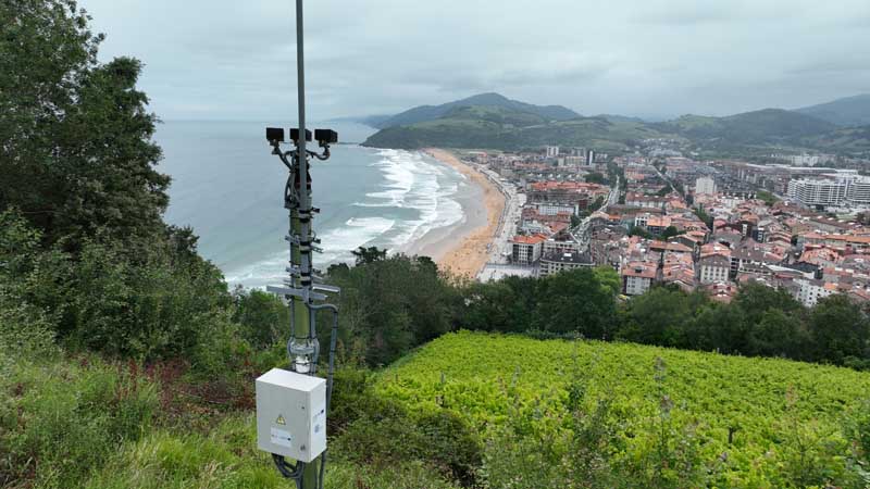
KOSTASystem: Videometry and coastal applications
Advanced digital services based on videometrics to monitor the coast in real time and address current and future climate risks.

Public administrations near the coast need new tools to forecast environmental situations linked to climate change, such as rising sea levels or adverse weather phenomena.
To fill this gap, the AZTI technology centre led the development of KOSTASystem technology, a videometry system that makes it possible to monitor the coastline by combining autonomous video cameras and algorithms for image processing. This technology has already been implemented in more than thirty coastal locations by administrations in Spain, France and Morocco.
In this line, AZTI has led the development of the KOSTASystem technology, a videometry system that makes it possible to monitor the coastline by combining autonomous video cameras and algorithms for image processing. Since 2004, these developments have been carried out with technological (ISURKI company, see TECHNOLOGY) and scientific collaboration (KOSTARISK cross-border joint laboratory made up of the SIAME team of the University of Pau and Adour countries, the Rivages ProTech centre of SUEZ and AZTI) to obtain products that transform images into useful information for coastal management, with short, medium and long-term applications.
The KOSTARISK pilot development area is included in CoastPredict’s Global Global Coast Experiment de Atlas of the Decade of the Oceans (Basque Country Pilot Site PS-018b-01).
Uses of KOSTASystem
- Coastline monitoring: Coastline monitoring and generation of morphological indicators of Climate Change
- Storm warning: Monitoring and warning systems against storms.
- Beach management: Detection and prediction of undertow currents and user density.

